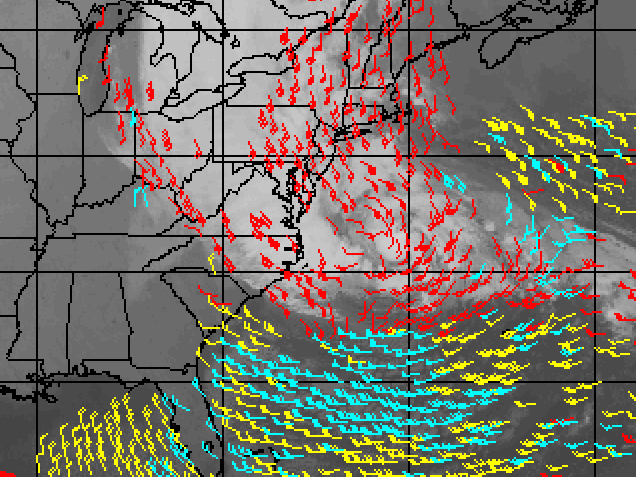
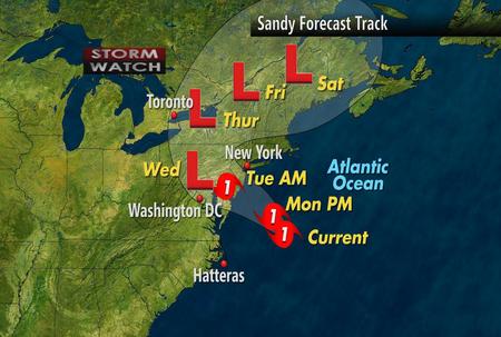
As of this morning reports from NOAA - The National Hurricane Center - has stated that what many are calling the Frankenstorm or Mammoth storm is now worsening, bringing more severe weather as it intensifies.
“...SANDY NOW MOVING NORTH-NORTHWESTWARD AND ACCELERATING...
...EXPECTED TO BRING LIFE-THREATENING STORM SURGE AND COASTAL
HURRICANE WINDS PLUS HEAVY APPALACHIAN SNOWS...”
Leaving many people wondering what is going to happen and preparing for the worst storm of the year thus far during the Hurricane season.

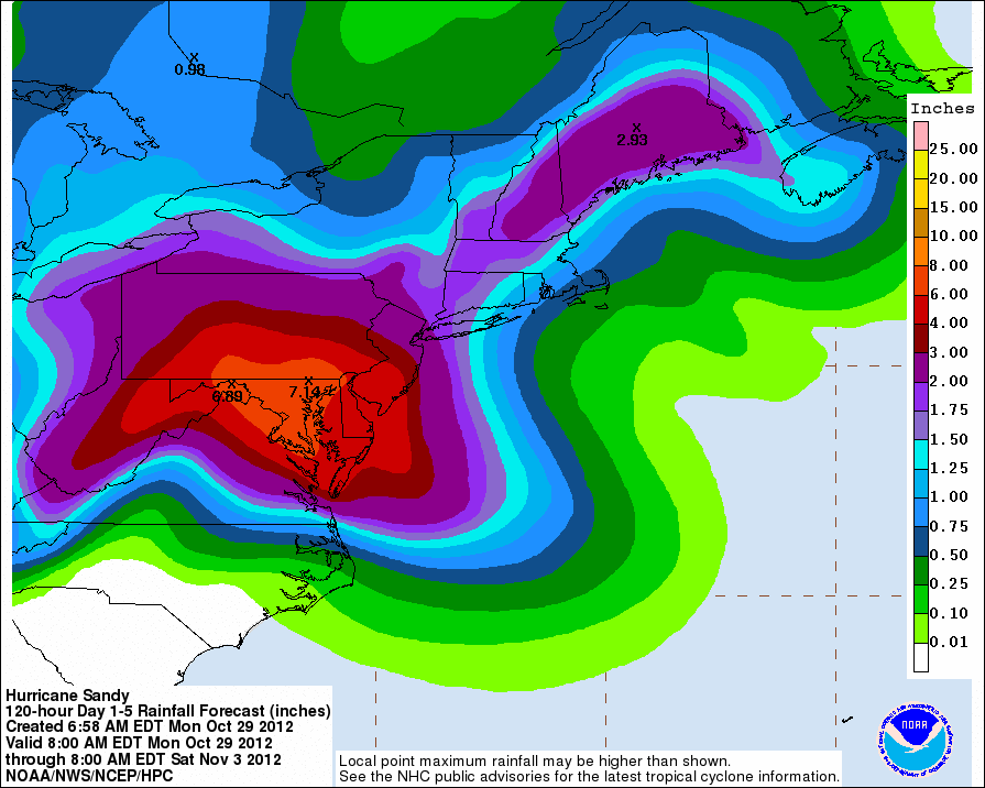
The North-East of the U.S. can expect a lot of rainfall in the next five days with some areas receiving as high as 7.14 inches of rain. To put it in perspective, rain drops range in size from 0.02 inches to about 0.033 inches that is approximately an inch of rain water, which is equal to about 15 inches of dry snow during an average rain storm/thunderstorm.

In History, On the East Coast, The New England Hurricane of 1938 is reported to have the fastest forward speed for a hurricane at 70 mph. The forward speed for an average hurricane is less than 20 mph, however as of 8am EST Hurricane Sandy is now northbound at near 14mph (22km/h). It's expected to turn northwest and west-northwest later today with possibility of strengthening, already becoming a “more than average” hurricane with possible wind gusts up to 90km/h in some areas.

Though much coverage is U.S. heavy, Canada is prepping for one of the worse storms it has ever seen, since according to the weather network, Hurricane Sandy looks to affect 23 million Canadians, which is 70% of the entire country’s population.
“New Brunswick and Nova Scotia can expect to see between 15 and 30 mm of rain, but amounts up to 60 mm are possible in extreme southwest New Brunswick and southern Nova Scotia," says Brian Dillon, a meteorologist at The Weather Network. Wind gusts will mostly be between 30 and 50 km/hour, but inland, gusts could reach as high as 80 km/hour."
The Internet may see some affects from the storm as well with Mashable first reporting a reminder of the data centers that Hurricane Sandy could encounter such as; Apple, Amazon, Google, Dropbox and Netflix and many social networks and social bookmarking sites depend heavily on these server farms in order to function properly.
This current Category 1 Hurricane looks massive and is predicted to do much damage to the East Coast of North America; however, we won’t know Sandy’s true strength until the storm passes and we are left with the aftermath.
For now, your best solution is to take to higher ground, prepare for the worse and take all measures in order for you to remain safe.
You can remain informed as well by using the Interactive Google Crisis Map.
NOTE: all images and information is subject to change as Hurricane Sandy progresses, check your local weather forecast to receive the latest updates for your area.
What steps are you taking to prepare for Hurricane Sandy?


